14-Day South Island Campervan: Christchurch to Queenstown
A one-way 14-day South Island campervan route from Christchurch to Queenstown via Tekapo, Aoraki, Wānaka, the glaciers and Milford Sound.
- 14 days · 13 nights
- About 1,750 km · 1,090 mi
- About 23 h at the wheel
- One-way, no ferry

João & Maria · Updated · 12 min read
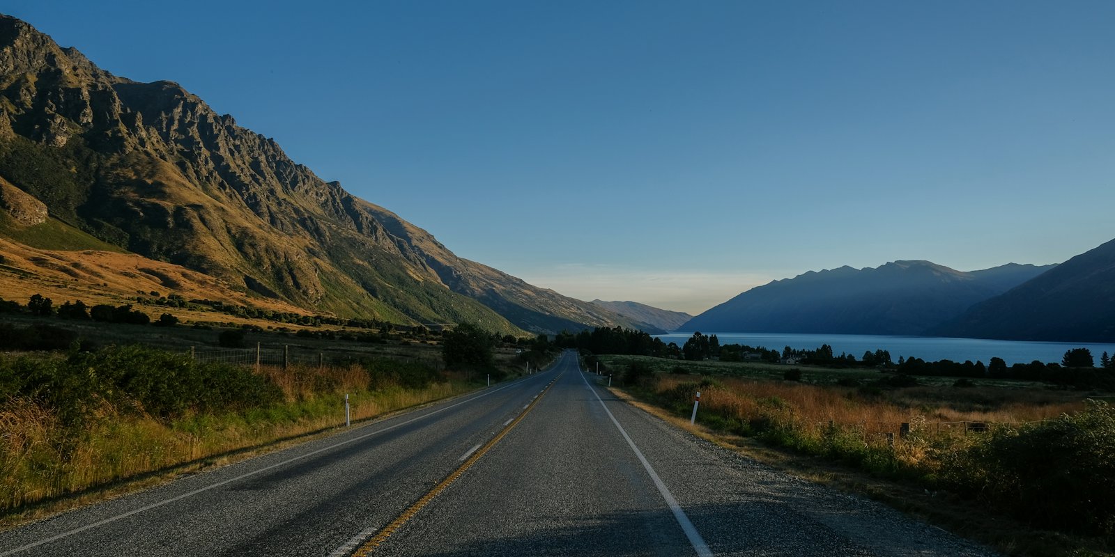
This route runs one way across the South Island, from Christchurch to Queenstown, in two weeks. It crosses the Mackenzie Basin to Lake Tekapo, climbs to Aoraki/Mount Cook, drops to Wānaka, then goes over Haast Pass to the West Coast glaciers. From there it comes back over the pass to Queenstown and finishes with Te Anau and the Milford Road.
The plan keeps most driving days to three or four hours and gives you a slower day after each long one. Where we can, we point you to Department of Conservation (DOC) campsites with booking details, plus a few holiday parks listed by regional tourism boards. Every distance and time below comes from an official page or a route planner, and the source list is at the end. Prices are as listed in October 2026 and they change, so check before you book.
At a glance
| Total distance | About 1,750 km (1,090 mi) on the main legs, before side trips |
| Driving hours | About 23 hours of driving time, before stops |
| Nights | 13 |
| Best months | Late spring to autumn. DOC says White Horse Hill is busiest from Christmas to mid-February and quieter from mid-February to Easter |
| Overnight options | DOC campsites (book online), holiday parks in towns, and freedom camping only where the rules allow |
| Start / end | Christchurch / Queenstown |
The leg totals add up as follows: Christchurch to Tekapo 227 km, Tekapo to Aoraki/Mount Cook Village 104 km, Mount Cook Village to Wānaka 207 km, Wānaka to Fox Glacier 262 km, Fox to Franz Josef 24 km, Franz Josef to Queenstown 351 km, Queenstown to Te Anau 170 km, Te Anau to Milford Sound and back 240 km, then Te Anau to Queenstown 170 km.
Before you go
No ferry needed. Christchurch and Queenstown are both on the South Island, so this route never touches Cook Strait. You only need a ferry if you are bringing a vehicle down from the North Island. For the wider picture, see our New Zealand campervan guide.
One-way logistics. Picking up in one city and dropping off in another usually costs extra, so ask about the one-way fee when you compare quotes. Our guide to campervan hire in New Zealand covers what to ask. On the first night, North South Holiday Park in Harewood is listed by ChristchurchNZ as the closest holiday park to Christchurch International Airport, about a 5-minute drive away and near the major campervan depots.
The green warrant. If you plan to freedom camp, the vehicle’s self-containment certification matters. DOC’s freedom camping page says that from 7 June 2026 all vehicles must have a “green warrant” to be certified self-contained. The warrant card must be displayed when you camp in areas restricted to self-contained vehicles. Vehicles with a portable toilet can no longer be certified; the toilet must be fixed to the floor. Ask your rental company to confirm the green warrant before you book. Our explainer on freedom camping rules in New Zealand goes deeper.
Book DOC sites early. Most DOC campsites on this route hold no spaces for walk-ins. You book online, same-day online bookings close at 8 pm if anything is left, and phone or visitor centre bookings carry a NZ$10 service fee (DOC pages, October 2026).
Day-by-day itinerary
Day 1–2: Christchurch to Lake Tekapo
Drive: 227 km (141 mi). The Mackenzie tourism board says the drive from Christchurch to Lake Tekapo takes about three hours. Allow extra if you stop in Geraldine or Fairlie.
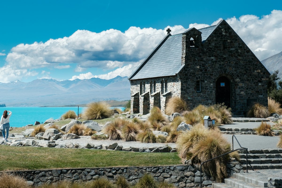
Highlights: Spend Day 1 collecting the van, shopping and settling in. The Christchurch Botanic Gardens sit in the heart of the city and make an easy first walk, with the Peacock Fountain and Armstrong Lawn. On Day 2, drive inland to Tekapo. The Church of the Good Shepherd stands on the lakefront off Pioneer Drive. It was built in memory of the Mackenzie pioneers from stone gathered within 5 miles (8 km) of the site. Tekapo is inside the Aoraki Mackenzie International Dark Sky Reserve, so a clear night is worth staying up for.
Where to sleep: Day 1 at North South Holiday Park near the airport. Day 2 at Lakes Edge Holiday Park at 2 Lakeside Drive, which lists powered and unpowered sites for campervans.
Day 3–4: Lake Tekapo to Aoraki/Mount Cook
Drive: About 104 km (65 mi). Mackenzie NZ gives 1 hour 15 minutes from Lake Tekapo to Aoraki/Mount Cook Village. It suggests a stop at the Lake Pukaki lookout on the way.
Highlights: The Hooker Valley Track starts at the White Horse Hill car park. It is about 5 km (3 mi) one way and takes about 1 hour 30 minutes each way to Hooker Lake at the foot of Aoraki/Mount Cook. DOC notes three swing bridges, including a new second bridge opened in July 2026 that is 189 m long. On Day 4, drive Tasman Valley Road to the Tasman Glacier View Track. DOC puts it at about 15 minutes up to the viewpoint on the moraine wall, with a short side trip to the Blue Lakes.
Where to sleep: Two nights at White Horse Hill Campsite, about 2.5 km from the village. DOC lists NZ$20 per adult and NZ$10 per child per night (October 2026). There is treated water, a cooking shelter and basic toilets, but no power or showers on site. Coin and card showers are in the village. DOC says the site is often full all year and keeps no walk-in spaces, so book.
Day 5–6: Aoraki/Mount Cook to Wānaka
Drive: About 207 km (129 mi) and roughly 2 hours 20 minutes, according to a route planner (secondary). Mackenzie NZ puts Twizel 45 minutes from the village. Fill up there, since the pump at Aoraki/Mount Cook is self-service and credit card only.
Highlights: Day 5 is a travel day with a lakefront evening in Wānaka. Day 6 is for walking. If you’re here in late spring, note that Roys Peak Track is closed from 1 October to 10 November. DOC recommends Isthmus Peak Track as an alternative of similar length and difficulty, and less busy. Roys Peak is a full day with over 1,200 m of climbing, and parking at the base is free for campervans.
Where to sleep: Holiday parks in Wānaka, or Kidds Bush Reserve Campsite on Lake Hāwea, about 32 km (20 mi) and 40 minutes north of Wānaka. DOC lists NZ$15 per adult per night. Read the access note first: DOC says Meads Road is gravel, narrow and steep in places and not suitable for large campervans. It is also often fully booked from Boxing Day to early February.
Day 7–8: Wānaka over Haast Pass to the glaciers
Drive: 262 km (163 mi) from Wānaka to Fox Glacier. Glacier Country Tourism lists it at 3 hours 14 minutes. DOC says about 140 km (87 mi) of State Highway 6 links Wānaka and Haast.
Highlights: The Haast Pass/Tioripatea highway tops out at 563 m. DOC lists short walks along it, including Blue Pools, Fantail Falls, Thunder Creek Falls and Roaring Billy Falls. The Blue Pools car park is 10 km past Makarora township when driving from Wānaka. It is about 30 minutes to the first swing bridge over the Makarora River, then a couple more minutes to the bridge above the pools.
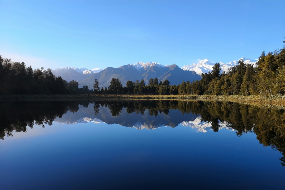
On Day 8, go early to Lake Matheson, about 5 minutes’ drive from Fox Glacier village. DOC gives 45 minutes return to the Jetty Lookout and 1 hour 30 minutes for the 4.4 km circuit. Reflections are best at dawn or dusk on a windless day. Then drive the 24 km (15 mi) to Franz Josef for the Franz Josef Glacier/Kā Roimata o Hine Hukatere Walk. The car park is about 4 km up the Glacier Access Road. DOC lists parking at NZ$2.50 per half hour or NZ$20 per day (October 2026). Stay behind the barriers; DOC warns of river surges, rockfall and flash flooding, and the track can close.
Where to sleep: Holiday parks in Fox Glacier or Franz Josef on Day 7. On Day 8, Otto/MacDonalds Campsite is 15 km north of Franz Josef at the northern end of Lake Mapourika. DOC lists NZ$18 per adult per night and says to book before you arrive, as mobile coverage there is limited.
Day 9–10: Back over Haast Pass to Queenstown
Drive: Glacier Country Tourism lists Franz Josef to Queenstown at 351 km (218 mi) and 4 hours 40 minutes. We’d split it with a night beside the Haast Highway. On Day 10, Wānaka to Queenstown is about 69 km (43 mi) and just under an hour, per a route planner (secondary).
Highlights: The pass looks different in the other direction, and you can pick up any walks you skipped on Day 7. Arrive in Queenstown by early afternoon on Day 10. Destination Queenstown lists the Tiki Trail, which starts just off Brecon Street, at about an hour.
Where to sleep: Day 9 at Pleasant Flat Campsite, beside SH6 45 km east of Haast with sealed access. Or try Cameron Flat Campsite, about 15 minutes north of Makarora by the Makarora River. Both list NZ$15 per adult per night (October 2026), and DOC advises not to camp under the trees. Day 10 at a holiday park in Queenstown.
Day 11–12: Queenstown, Glenorchy and on to Te Anau
Drive: Day 11 is optional. Destination Queenstown describes Glenorchy as a scenic 45-minute drive from town. On Day 12, Fiordland’s tourism board lists Queenstown to Te Anau at 170 km (105.5 mi). It says to allow 2 hours, which includes rest stops but not sightseeing.
Highlights: On the Glenorchy road, Bob’s Cove is about a 20-minute walk to the water. At the head of the lake, the Glenorchy Lagoon Walkway takes 1 to 2 hours. On Day 12, settle into Te Anau, stock up on food and fill the tank. There is no fuel between Te Anau and Milford Sound.
Where to sleep: Day 11 in Queenstown again. Day 12 at Henry Creek Campsite, 23 km north of Te Anau beside Lake Te Anau, on a gravel road. DOC lists space for campervans and NZ$18 per adult per night. It is the closest DOC campsite to Te Anau on the Milford Road, which gives you a head start in the morning.
Day 13–14: Milford Sound and back to Queenstown
Drive: Te Anau to Milford Sound is 120 km (74.5 mi), and Fiordland’s tourism board says to allow 2 hours. DOC’s Milford Road tips give 240 km (149 mi) for the round trip. DOC suggests allowing about eight hours for the day, including stops, short walks and a boat cruise. Day 14 is the 170 km (105.5 mi) run back to Queenstown, about 2 hours.
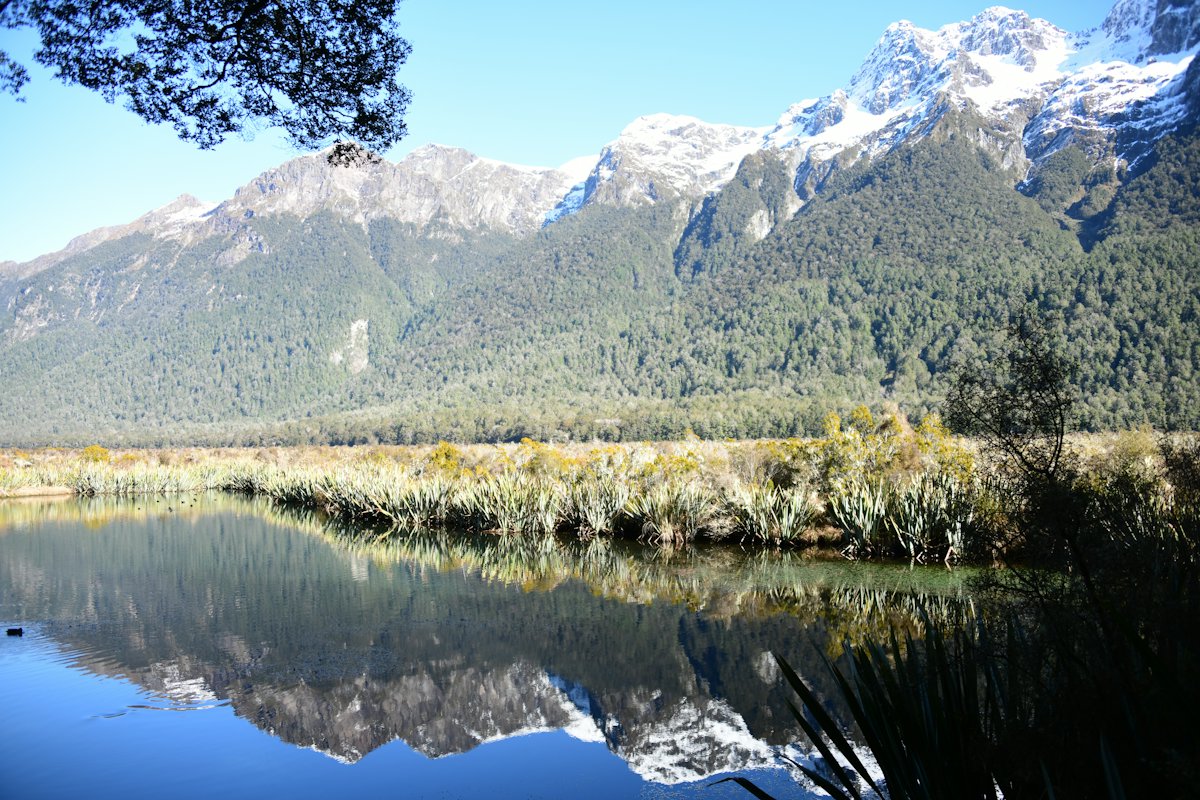
Highlights: Fiordland’s Milford Road walks page lists Mirror Lakes at 10 minutes on a wheelchair-accessible boardwalk, about 56 km north of Te Anau. It also lists the Lake Gunn Nature Walk, a 45-minute loop from the Cascade Creek car park. Key Summit, from The Divide, takes 3 to 5 hours return if you want a bigger walk. The same page lists The Chasm as closed after flood damage in February 2020, so check with DOC before you plan on it. Then take a cruise on the sound.
Where to sleep: If you’d rather be first on the road in the morning, Cascade Creek Campsite is 71 km north of Te Anau at the lower end of Lake Gunn. DOC rates it good for larger vehicles, at NZ$18 per adult per night. Otherwise, return to Henry Creek or a Te Anau holiday park for the last night. DOC notes there are no dump stations at the Milford Road campsites; the nearest are in Te Anau and Manapōuri.
Driving notes
One-lane bridges. You will cross plenty of them. Drive Safe, run by Tourism Industry Aotearoa, says signs show which direction must give way and that the big arrow has the right of way. If unsure, let the other vehicle go first. Even with priority, slow down and check nobody is already on the bridge.
Pulling over. Drive Safe says campervan drivers should pull over when safe if traffic backs up behind them. On open roads, you must pull over if five or more vehicles are queued behind you. It also warns that New Zealand driving times are easy to underestimate.
Haast Pass. DOC describes the Haast Pass road as “virtually an all-weather road.” It is still a long, winding mountain highway with few services. Pleasant Flat and Cameron Flat are the main DOC stops between Haast and Makarora, so plan breaks there. We could not confirm current fuel hours at Makarora or Haast, so fill up in Wānaka or at Fox Glacier before the crossing.
Milford Road chains and the no-stopping zone. DOC says chains may be required in winter (May to September) and can be hired in Te Anau. Learn to fit them before you leave. The section between the Hollyford Road junction and The Chasm is a Restricted No Stopping Zone because it is avalanche terrain, so keep moving through it. Check the NZTA road status page for closures on the morning you drive.
Snow elsewhere. Drive Safe advises carrying chains you know how to fit in winter (June to August). DOC notes that snow can close SH80 to Aoraki/Mount Cook, and that White Horse Hill has reduced facilities from June to August.
Fuel gaps. Mackenzie NZ lists fuel at Fairlie, Lake Tekapo and Twizel. At Aoraki/Mount Cook there is only a self-service pump that takes credit cards. There is no fuel between Te Anau and Milford Sound. A useful habit is to top up whenever you pass a station below half a tank.
Shorter or longer versions
10 days. Cut the West Coast. From Wānaka, go straight to Queenstown and on to Te Anau. You lose Haast Pass and the glaciers, plus about 570 km (354 mi) of driving. That leaves time for a slower Aoraki and Fiordland.
12 days. Keep the full route but drop the Glenorchy day and one of the two Aoraki nights. The days get fuller, with less slack if weather closes a road.
18 to 21 days. Add a night at each end of the West Coast leg so the 351 km return over Haast Pass isn’t rushed. Add a second Fiordland night so you have a weather day for Milford. Christchurch to Te Anau direct is 652 km (405 mi) and about 8 hours, per Fiordland’s tourism board, which shows how much ground the loop covers. If you have even longer and want another island loop, our Tasmania campervan guide has a similar pace.
Whatever length you choose, our campervan packing list covers chains, sandfly repellent and layers.
Frequently asked questions
How long is the drive from Christchurch to Queenstown on this route?
The main legs add up to about 1,750 km (1,090 mi) and about 23 hours of driving, before side trips. That includes the West Coast detour and the return drive to Milford Sound. Sources for each leg are linked in the itinerary above.
Do I need to book DOC campsites in advance?
For most of the sites on this route, yes. White Horse Hill, Henry Creek, Cascade Creek, Pleasant Flat, Cameron Flat and Otto/MacDonalds all ask you to book online and hold no walk-in spaces, according to DOC. Same-day online bookings close at 8 pm if spaces remain.
Can I freedom camp with a rental campervan?
Only in a vehicle certified as self-contained, and only where local rules allow it. DOC says that from 7 June 2026 all vehicles need a green warrant to count as self-contained, and portable toilets no longer qualify. Ask your rental company to show you the warrant card before you drive away.
Is the Milford Road open all year?
It is a year-round alpine road, but it can close in bad weather or high avalanche risk. DOC says chains may be required from May to September and that there is no fuel between Te Anau and Milford Sound. Check the NZTA road status on the morning you plan to drive.
Is 14 days enough for the South Island?
It is enough for this one-way route from Christchurch to Queenstown at a steady pace, with a few slower days. It does not cover the top of the South Island, such as Nelson or Kaikōura. If you want those too, plan on three weeks or more.